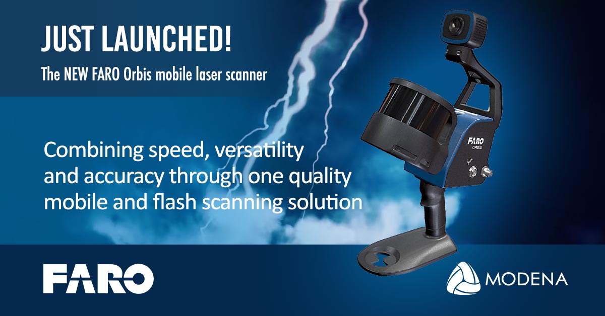
Unveiling the FARO Orbis, Transforming Industry Scanning with Combined Mobility and Precision
Advertising
13-11-2023
Read : 261 times
Leads 2 Business
Unveiling the FARO Orbis, Transforming Industry Scanning with Combined Mobility and Precision
Modena Infrastructure introduces FARO Orbis, a revolutionary mobile scanning solution that seamlessly integrates portable efficiency with stationary precision.
This cutting-edge device, powered by Flash Technology™, enables professionals in construction, engineering, and surveying to capture highly accurate data in real-time whilst navigating job sites, also offering stationary scanning for detailed areas like complex pipework.
Features
Lightweight and Easy-to-Use - Weighing just 3.6kg, including the datalogger and battery, Orbis is ideal for scanning large areas fast, without large setups.
Higher Levels of Accuracy - A precision of 5mm during a mobile scan and 2mm during stationary Flash scanning makes Orbis the ultimate mobile scanning solution for high levels of accuracy.
Ideal for Internal and External Mapping - With up to 120 meters in range, Orbis is the ideal solution for both indoor and outdoor scanning, with the ability to seamlessly transition between both.
Best of Both Worlds Processing - Orbis offers local processing in the FARO Connect software or optional FARO Sphere® XG Digital Reality platform – flexible solutions for processing, analysing and sharing data.
360° Photos and Colorized Data - The integrated 8-megapixel camera on the Orbis enables colorized point clouds and additional 360° panoramic pictures.
Engineered for the Toughest Environments - Engineered with the toughest environments in mind, Orbis has the capacity to map places like underground mines, dense forests or construction sites with ease.
The All-in-one Mapping Solution - The Orbis is compatible with a monopod for stationary Flash scanning, car mount for capturing larger areas, backpack for tough terrain, and cradle for descending into a mine shaft, it is truly an all-in-one solution.
The Orbis boasts a host of advantages, including rapid data collection, Building information Modelling (BIM) scans of construction sites, comparing point cloud data against CAD models, enhanced speed, and efficiency in data capture for building asset management as well as improving workflows and enabling the capture of large sites in shorter times for geospatial projects.
In the mining sphere, advantageous solutions include convergence analysis - reviewing rock formation without holding up production, keeping mines on track with production progress data capture compared to pre-existing plans, vertical shaft inspections, and maintaining accurate volumetric data for stockpiles through fast and repetitive scanning.
FARO Orbis, powered by GeoSLAM's proprietary SLAM algorithm, signifies a significant advancement for industry professionals, enabling the delivery of highly accurate results faster while minimizing human error and boosting overall efficiency.
To find out more or download specifications, click here: Faro Orbis 3d laser scanner - Modena AEC and Infrastructure - Architecture | Engineering | Construction (modena-aec.co.za)
Or contact Noeleen Forster directly on 072 213 4954 or reach out at noeleen@modena-aec.co.za
Recent News
Here are recent news articles from the Building and Construction Industry.
Have you signed up for your free copy yet?