Council approves new spatial vision for Maitland
28-03-2024
Read : 136 times
Cbn
Source
The City of Cape Town’s Council approved the local spatial development framework (LSDF) for Maitland at its meeting on Wednesday 27 March. The LSDF was drafted in collaboration with the local community and business owners. The spatial vision intends to revitalise the area by guiding public infrastructure investment and unlocking developments that will assist with job creation, among others.
Maitland is strategically located within the Urban Inner Core which the City has prioritised for investment. It is also a development focus area, and an economic node located within the Urban Development Zone, meaning there are tax incentives to facilitate sustainable urban regeneration and job creation.
‘We started with the drafting process in March last year and relied on the opportunities and constraints to guide us, among which a growing population and density and the pressure this puts on aging services infrastructure; the lack of high quality open spaces; and localised flooding caused by the Black River.
‘The local residents, business community, and other stakeholders contributed to this contextual analysis report which informed the draft LSDF. We hosted at least seven public engagements and in September last year we once again asked the public to participate and submit comments which we have assessed in finalising the spatial vision that has now been approved by Council,’ said the City’s Deputy Mayor and Mayoral Committee Member for Spatial Planning and Environment, Alderman Eddie Andrews.
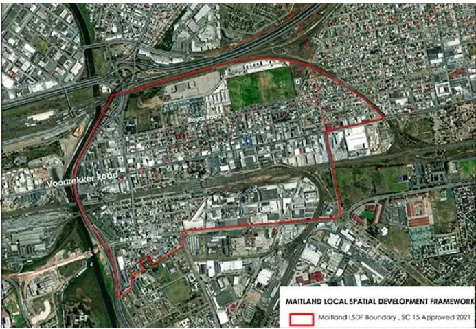
The now approved LSDF determines the development vision for Maitland on an area level. Going forward, the City will use the LSDF for guidance when making decisions about development applications and land uses; and in the end, these decisions will determine what Maitland will look and feel like a few years down the line.
‘Maitland has a lot going for it, its unique location means it is easily accessible from Kensington, Ndabeni, and Paarden Island; is in close proximity to the Cape Town CBD and Bellville CBD’s labour markets; has multiple public transit modes; and zonings that allow for industrial, community, mixed use and medium-high density residential uses.
‘On the other hand, we are experiencing the impact of passenger rail decline, continuous load-shedding and ageing infrastructure on Maitland. And there are also some constraints that are limiting the area’s potential, among which the Black River flood line, and connectivity barriers such as the river, the M5 freeway, and rail infrastructure. As such, the City will use the LSDF as a policy instrument to guide public and private investment to build on Maitland’s potential and mitigate the impact of the constraints,’ said Alderman Andrews.
The Maitland LSDF pursues a spatial vision that will assist with the regeneration of the area:
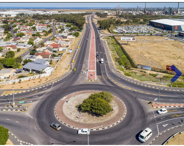
- Maitland represents the gateway to Voortrekker Road which is a development corridor and activity route; the Urban Development Zone along Maitland and Kensington offers an opportunity of urban regeneration with a diversity of mixed uses that will be supported by the first phase of the Voortrekker Road Streetscape and road widening.
- Prioritised, coordinated and sequenced City improvements of Maitland’s road infrastructure are important catalysts for urban regeneration and include the planned new MyCiTi bus station and proposed upgrade of Berkley Road. The projects will enhance and enable the movement of goods and people, and facilitate an improved public realm for better access supported by job generating activities. The City is currently sourcing comment from the public about the proposed upgrade of Berkley Road: capetown.gov.za/City-Connect/Have-your-say/Issues-open-for-public-comment/upgrade-of-berkley-road-in-maitland,
- Prioritising universally accessible and safe pedestrian movement
- Using the Black River as an asset to create new opportunities and improved access between Maitland and the river
- Improving access and connectivity with the creation of integrated and inclusive communal spaces
The LSDF also includes:
- Maps to reflect current and future elements such as road networks, public transport systems, public open spaces, and public facilities
- Land use management guidelines, guidance on improved connectivity and greater accessibility to support a high quality urban form and universally accessible public realm in line with transit orientated development
- The spatial proposals to improve the urban space, among which indicating areas where public and private development should be prioritised, and areas in need of strategic intervention to pursue the vision of a City of Hope for Maitland
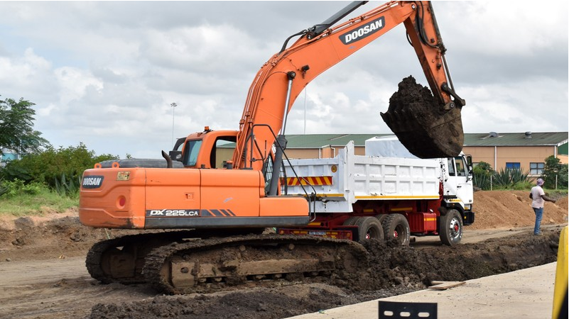
- Key infrastructure requirements to enable the spatial vision have been prioritised, sequenced and phased as part of the implementation plan
- An implementation plan indicating City projects at a concept stage, and others that have been confirmed and those that are already underway to realise the spatial vision
- Technical input and analysis led by the City’s Urban Planning and Design Department, with input from City line departments, the Western Cape Government, National Ports Authority, Transnet and National Department of Public Works
- The Maitland LSDF elaborates on and supports the spatial development guidelines as set out in the Table Bay District Spatial Development Framework, which is a higher order plan for the greater Table Bay area; and the City’s Municipal Spatial Development Framework that sets the overall spatial vision for Cape Town.
The LSDF for Maitland is available on the City’s website at the following link: https://bit.ly/3IVcqFs
Recent News
Here are recent news articles from the Building and Construction Industry.
Have you signed up for your free copy yet?